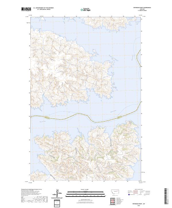
2024 Map of Peterson Point
USGS Topo · Published 2024About this map
Missouri River watercourses define the border between Valley and Garfield counties as shown in this 2024 survey. The landscape is dominated by the broken terrain of the Charles M Russell National Wildlife Refuge, where a network of drainages including Cole Creek and Bighorn Coulee cut toward the river valley. The eponymous Peterson Point stands as a prominent landmark on the southern shore, overlooking the winding river channel.
Find a feature on this map
14 named features on this map. Tap any name to fly to it.
Don’t see what you’re looking for? This feature index may not catch every label — zoom into the map to look around manually.
Map Details
Editions of this 2024 Peterson Point Map
This is the sole edition of this map. No revisions or reprints were ever made.
Other maps of this area

1954 · Jordan
USGS Topo · 1:250,000

1956 · Jordan
USGS Topo · 1:250,000

1958 · Jordan
USGS Topo · 1:250,000

1958 · Collins Ranch
USGS Topo · 1:62,500

1958 · Maloney Hill
USGS Topo · 1:62,500

1964 · Jordan
USGS Topo · 1:250,000

1971 · Trumbo Ranch
USGS Topo · 1:24,000

1971 · Harper Camp
USGS Topo · 1:24,000
1973 · Murray Hill
USGS Topo · 1:24,000

1978 · Fort Peck Lake West
USGS Topo · 1:100,000