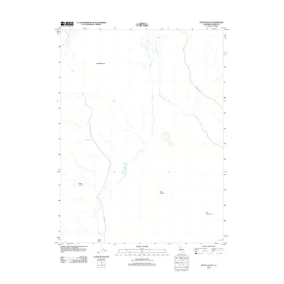
2012 Map of Petes Valley
USGS Topo · Published 2012About this map
Petes Valley and the surrounding high desert terrain of Lassen County define this landscape, where water sources like Wire Spring and Mapes Spring provide vital points in an otherwise arid environment. The drainage system is anchored by Petes Cr and Snowstorm Cr, which carve through the distinct geological formations of the region. Notable elevations and landforms include the prominent Black Mountain and the expansive The Tablelands, alongside The Buttes. A sparsely developed road network, including Snowstorm Rd and Road 28G32, connects these remote features. The presence of the label Secret suggests a localized name of interest to researchers of regional nomenclature. The terrain's character is further shaped by the steep descent of Long Canyon, illustrating the varied topography of this section of northeastern California.
Find a feature on this map
13 named features on this map. Tap any name to fly to it.
Don’t see what you’re looking for? This feature index may not catch every label — zoom into the map to look around manually.
Map Details
Editions of this 2012 Petes Valley Map
This is the sole edition of this map. No revisions or reprints were ever made.
Other maps of this area

1886 · Honey Lake
USGS Topo · 1:250,000

1891 · Honey Lake
USGS Topo · 1:250,000

1893 · Honey Lake
USGS Topo · 1:250,000

1954 · Susanville
USGS Topo · 1:62,500

1954 · Litchfield
USGS Topo · 1:62,500

1954 · Karlo
USGS Topo · 1:62,500

1954 · Fredonyer Peak
USGS Topo · 1:62,500

1955 · Westwood
USGS Topo · 1:250,000

1958 · Westwood
USGS Topo · 1:250,000

1959 · Westwood
USGS Topo · 1:250,000