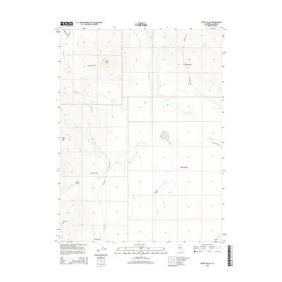
2015 Map of Petes Valley
USGS Topo · Published 2015About this map
Petes Valley and its high-desert topography define this corner of Lassen County, where intermittent drainage and volcanic landforms shape the landscape. Named peaks like Black Mtn, Horse Lake Mtn, and Tunnison Mtn create a rim around the central basins, which are fed by seasonal flows from Petes Cr and Snowstorm Cr. Essential water sources for the cattle and wildlife in this arid region are marked by Wire Spring and Mapes Spring.
Find a feature on this map
21 named features on this map. Tap any name to fly to it.
Don’t see what you’re looking for? This feature index may not catch every label — zoom into the map to look around manually.
Map Details
Editions of this 2015 Petes Valley Map
This is the sole edition of this map. No revisions or reprints were ever made.
Other maps of this area

1886 · Honey Lake
USGS Topo · 1:250,000

1891 · Honey Lake
USGS Topo · 1:250,000

1893 · Honey Lake
USGS Topo · 1:250,000

1954 · Susanville
USGS Topo · 1:62,500

1954 · Litchfield
USGS Topo · 1:62,500

1954 · Karlo
USGS Topo · 1:62,500

1954 · Fredonyer Peak
USGS Topo · 1:62,500

1955 · Westwood
USGS Topo · 1:250,000

1958 · Westwood
USGS Topo · 1:250,000

1959 · Westwood
USGS Topo · 1:250,000