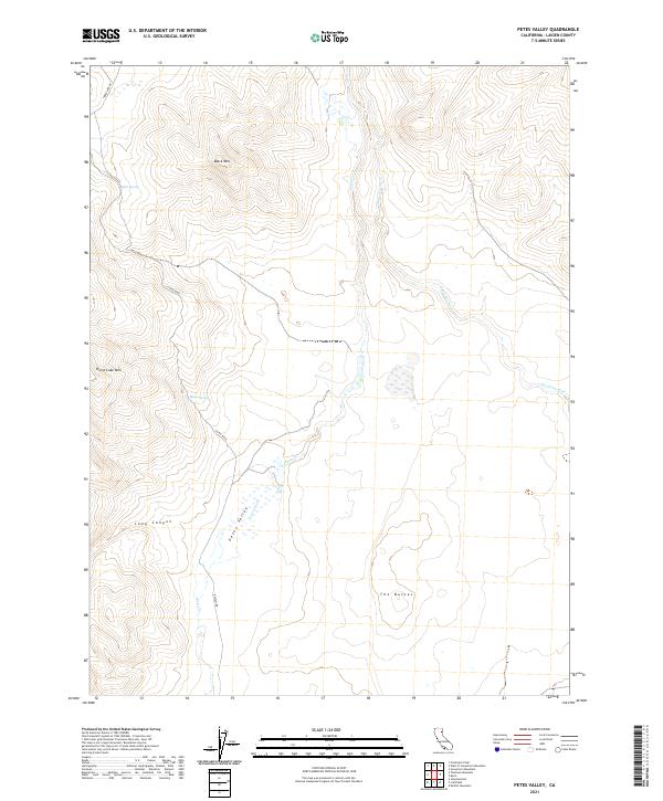
2021 Map of Petes Valley
USGS Topo · Published 2021About this map
Petes Valley Petes Creek defines the lower drainage of this high-altitude landscape in Lassen County, where intermittent waterways and isolated springs dictate the layout of the land. High elevations are anchored by Horse Lake Mtn and Black Mtn, separated by the deep incision of Long Canyon. The presence of Mapes Spring and Wire Spring highlights the critical importance of water sources in this arid region. Transportation across this portion of the Great Basin is facilitated by remote corridors such as Horselake Rd and Belfast Rd, which connect the scattered topographic landmarks. To the east, the drainage of Snowstorm Cr and the unique formation of The Buttes provide distinct navigational points for those tracing the historical survey lines of the Public Land Survey System.
Find a feature on this map
16 named features on this map. Tap any name to fly to it.
Don’t see what you’re looking for? This feature index may not catch every label — zoom into the map to look around manually.
Map Details
Editions of this 2021 Petes Valley Map
This is the sole edition of this map. No revisions or reprints were ever made.
Other maps of this area

1886 · Honey Lake
USGS Topo · 1:250,000

1891 · Honey Lake
USGS Topo · 1:250,000

1893 · Honey Lake
USGS Topo · 1:250,000

1954 · Susanville
USGS Topo · 1:62,500

1954 · Litchfield
USGS Topo · 1:62,500

1954 · Karlo
USGS Topo · 1:62,500

1954 · Fredonyer Peak
USGS Topo · 1:62,500

1955 · Westwood
USGS Topo · 1:250,000

1958 · Westwood
USGS Topo · 1:250,000

1959 · Westwood
USGS Topo · 1:250,000