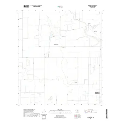
2019 Map of Petronila NE
USGS Topo · Published 2019About this map
The coastal plains of Nueces County just west of Corpus Christi appear here in a landscape defined by agricultural infrastructure and the winding course of Oso Creek. The small community of Petronila stands at a rural junction in the southwestern portion of the sheet, while the newer residential development of Tierra Grande is situated further north. Local industry is anchored by the Oso Gin, which sits along Oso Gin Rd near the drainage of W Oso Creek. The layout of the land is heavily influenced by a grid of farm-to-market roads and county routes, including Blackie Berry Rd and FM 665, which connect the inland fields to the growing periphery of the city. Genealogists may find interest in the Memory Gardens Cem or the localized naming of rural avenues like Tierra Poniente and Santa Maria Ln.
Find a feature on this map
44 named features on this map. Tap any name to fly to it.
Don’t see what you’re looking for? This feature index may not catch every label — zoom into the map to look around manually.
Map Details
Editions of this 2019 Petronila NE Map
This is the sole edition of this map. No revisions or reprints were ever made.
Other maps of this area

1924 · Petronilla
USGS Topo · 1:62,500

1925 · Robstown
USGS Topo · 1:62,500

1925 · Oso Creek
USGS Topo · 1:62,500

1925 · Corpus Christi
USGS Topo · 1:62,500

1950 · Corpus Christi
USGS Topo · 1:250,000

1951 · Corpus Christi
USGS Topo · 1:24,000

1951 · Corpus Christi
USGS Topo · 1:62,500

1951 · Oso Creek NW
USGS Topo · 1:24,000

1951 · Oso Creek
USGS Topo · 1:62,500

1954 · Robstown
USGS Topo · 1:62,500