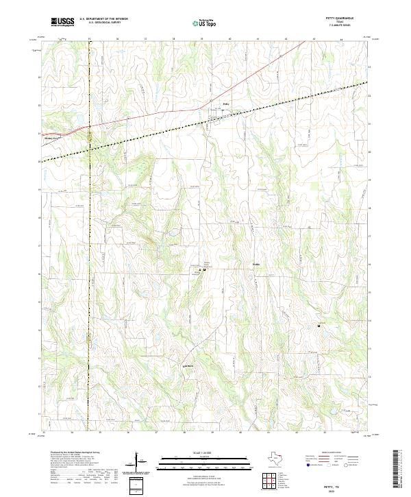
2022 Map of Petty
USGS Topo · Published 2022About this map
Petty serves as a central hub for this rural Northeast Texas landscape, positioned just east of the Fannin Co Lamar Co line. The topography is defined by a dense network of seasonal drainages including Ghost Creek, Rowdy Creek, and Noble Creek, which carve through the gently sloping countryside. This survey captures the region as a settled agricultural expanse, characterized by small communities like Noble and Harmon connected by farm-to-market roads such as FM 137 and FM 38. Local heritage is anchored by significant sites like Hickory Grove Cemetery and Hickory Grove Black Cemetery, alongside Lee Cemetery further east. These landmarks, along with the scattered farmsteads, provide a clear record of the area's long-standing family settlements and rural development patterns.
Find a feature on this map
25 named features on this map. Tap any name to fly to it.
Don’t see what you’re looking for? This feature index may not catch every label — zoom into the map to look around manually.
Map Details
Editions of this 2022 Petty Map
This is the sole edition of this map. No revisions or reprints were ever made.
Other maps of this area

1903 · Paris
USGS Topo · 1:125,000

1947 · Honey Grove
USGS Topo · 1:62,500

1948 · Paris
USGS Topo · 1:62,500

1949 · Honey Grove
USGS Topo · 1:62,500

1949 · Paris
USGS Topo · 1:62,500

1953 · Texarkana
USGS Topo · 1:250,000

1956 · Texarkana
USGS Topo · 1:250,000

1964 · Cooper North
USGS Topo · 1:24,000

1964 · Ladonia
USGS Topo · 1:24,000

1964 · Pecan Gap
USGS Topo · 1:24,000