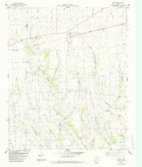
1984 Map of Petty
USGS Topo · Published 1985About this map
Petty serves as a central hub for this northeast Texas landscape, situated along the Missouri Pacific railroad. The surrounding terrain is defined by a dense network of drainage, where Threemile Creek, Ghost Creek, and Rowdy Creek carve through the agricultural lands of Lamar and Fannin counties. Smaller rural settlements like White Rock, Noble, and Harmon are scattered across the map, representing the established farming communities of the mid-1980s. Local history is anchored by sites like Hickory Grove Cem and Mc Glasson Cem, which provide essential points of reference for genealogical research. The map also documents technical infrastructure, including the Radio Tower and the survey markers Petty W Base and Petty E Base, illustrating the area's role in regional communications and surveying networks.
Find a feature on this map
25 named features on this map. Tap any name to fly to it.
Don’t see what you’re looking for? This feature index may not catch every label — zoom into the map to look around manually.
Map Details
Editions of this 1984 Petty Map
This is the sole edition of this map. No revisions or reprints were ever made.
Other maps of this area

1903 · Paris
USGS Topo · 1:125,000

1947 · Honey Grove
USGS Topo · 1:62,500

1948 · Paris
USGS Topo · 1:62,500

1949 · Honey Grove
USGS Topo · 1:62,500

1949 · Paris
USGS Topo · 1:62,500

1953 · Texarkana
USGS Topo · 1:250,000

1956 · Texarkana
USGS Topo · 1:250,000

1964 · Cooper North
USGS Topo · 1:24,000

1964 · Ladonia
USGS Topo · 1:24,000

1964 · Pecan Gap
USGS Topo · 1:24,000