1970 Map of Peyton
USGS Topo · Published 1973About this map
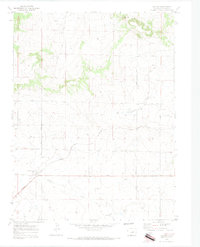
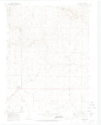
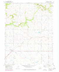
Peyton serves as the primary settlement hub on this High Plains landscape, situated along the vital transport corridor of the Chicago Rock Island and Pacific railroad. The map reveals a transition from the structured street grid of the town to a rugged natural geography defined by the Bijou Basin and the prominent height of Fremont Fort. Local history is anchored by essential community features like the small Cem west of town and a network of namesake rural thoroughfares including Murphy Road, Dzuris Road, and Sweet Road. The drainage patterns of Brackett Creek and Sandy Creek cut through the terrain, while numerous gravel pits indicate the local extractive industry that supported road and rail construction in the mid-century era. This survey, based on 1968 photography, preserves the rural character of El Paso County before subsequent suburban expansion.
Find a feature on this map
17 named features on this map. Tap any name to fly to it.
Don’t see what you’re looking for? This feature index may not catch every label — zoom into the map to look around manually.
Map Details
Editions of this 1970 Peyton Map
3 editions found
Other maps of this area

1893 · Big Springs
USGS Topo · 1:125,000

1893 · Colorado Springs
USGS Topo · 1:125,000

1894 · Castle Rock
USGS Topo · 1:125,000

1909 · Colorado Springs
USGS Topo · 1:125,000

1913 · Castle Rock
USGS Topo · 1:125,000

1940 · Elbert
USGS Topo · 1:62,500

1942 · Colorado Springs
USGS Topo · 1:125,000

1944 · Elbert
USGS Topo · 1:62,500

1948 · Falcon
USGS Topo · 1:24,000

1948 · Falcon
USGS Topo · 1:62,500