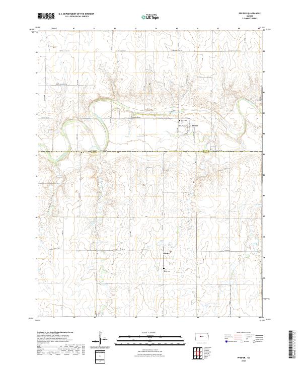
2022 Map of Pfeifer
USGS Topo · Published 2022About this map
The Smoky Hill River meanders through this portion of the Kansas plains, carving a distinct valley through the section lines of Ellis and Rush counties. The settlement of Pfeifer serves as a primary local landmark, anchored by the Holy Cross Cem and a grid of streets including Saint Jacob St and Sarratov St. To the south, the smaller community of Loretta is situated near Saint Mary's Cem, reflecting the era's pattern of small, church-centered rural clusters. The landscape is further defined by natural drainages such as Shelter Cr and Duck Cr, alongside the evocative Hungry Hollow. A dense network of section roads like Chetolah Gold Rd and Schoenchen Rd provides a detailed view of the agricultural geometry that governs this region.
Find a feature on this map
45 named features on this map. Tap any name to fly to it.
Don’t see what you’re looking for? This feature index may not catch every label — zoom into the map to look around manually.
Map Details
Editions of this 2022 Pfeifer Map
This is the sole edition of this map. No revisions or reprints were ever made.
Other maps of this area

1896 · Hays
USGS Topo · 1:125,000

1955 · Great Bend
USGS Topo · 1:250,000

1957 · Great Bend
USGS Topo · 1:250,000

1958 · Great Bend
USGS Topo · 1:250,000

1961 · Hays South
USGS Topo · 1:24,000
1961 · Walker
USGS Topo · 1:24,000

1961 · Victoria
USGS Topo · 1:24,000
1965 · Otis
USGS Topo · 1:24,000

1966 · La Crosse
USGS Topo · 1:24,000
1966 · Bison
USGS Topo · 1:24,000