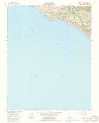
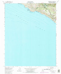
1956 Map of Pfeiffer Point
USGS Topo · Published 1984About this map
Pfeiffer Big Sur State Park dominates this coastal landscape where the Big Sur River meets the sea. The 1956 survey, with photorevisions from 1981, captures a transition between protected wilderness and the managed recreation of Los Padres National Forest. The map documents early community landmarks like the Pfeiffer Sch and the Big Sur Guard Sta, alongside a small Dam on the river. Coastal topography is rendered in sharp detail from Cooper Point down to the rocky outcroppings of Pfeiffer Rock and the sands of Wreck Beach. Further inland, the map identifies small family-named sites such as Graves and Posta, likely associated with earlier homesteading or ranching in the Mule Canyon area. The presence of the State Game Refuge and Ventana Wilderness Boundary highlights the long-standing conservation efforts along this portion of the Coast Hwy.
Find a feature on this map
27 named features on this map. Tap any name to fly to it.
Don’t see what you’re looking for? This feature index may not catch every label — zoom into the map to look around manually.
Map Details
Editions of this 1956 Pfeiffer Point Map
5 editions found
Other maps of this area

1918 · Point Sur
USGS Topo · 1:62,500

1920 · Jamesburg
USGS Topo · 1:48,000

1921 · Jamesburg
USGS Topo · 1:62,500

1921 · Lucia
USGS Topo · 1:62,500

1925 · Point Sur
USGS Topo · 1:62,500

1939 · Jamesburg
USGS Topo · 1:62,500

1940 · Jamesburg
USGS Topo · 1:62,500

1941 · Lucia
USGS Topo · 1:62,500

1947 · Lucia
USGS Topo · 1:62,500

1947 · Jamesburg
USGS Topo · 1:62,500