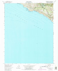
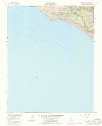
1956 Map of Pfeiffer Point
USGS Topo · Published 1987About this map
Pfeiffer Big Sur State Park dominates this coastal landscape, where the Big Sur River meets the Pacific. The survey reveals a community centered on early conservation and recreation infrastructure, including the Big Sur Guard Sta and the Pfeiffer Sch. Moving south from Sawmill Flat Campground, the map details a rugged transition from redwood-lined canyons to the dramatic sea cliffs of Pfeiffer Point and Pfeiffer Rock. Inland, the California State Game Refuge and Los Padres National Forest protect the upland ridges of Clear Ridge and Sycamore. Local genealogy and habitation are noted through family-named sites like Posts and Graves, alongside small structures at Weyland Camp. This edition reflects the mid-century character of the region before further modern development, preserving the locations of early landmarks like the Dam and several Falls.
Find a feature on this map
28 named features on this map. Tap any name to fly to it.
Don’t see what you’re looking for? This feature index may not catch every label — zoom into the map to look around manually.
Map Details
Editions of this 1956 Pfeiffer Point Map
5 editions found
Other maps of this area

1918 · Point Sur
USGS Topo · 1:62,500

1920 · Jamesburg
USGS Topo · 1:48,000

1921 · Jamesburg
USGS Topo · 1:62,500

1921 · Lucia
USGS Topo · 1:62,500

1925 · Point Sur
USGS Topo · 1:62,500

1939 · Jamesburg
USGS Topo · 1:62,500

1940 · Jamesburg
USGS Topo · 1:62,500

1941 · Lucia
USGS Topo · 1:62,500

1947 · Lucia
USGS Topo · 1:62,500

1947 · Jamesburg
USGS Topo · 1:62,500