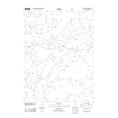
2012 Map of Phantom Lake
USGS Topo · Published 2012About this map
Gold Hill and the surrounding high-elevation basin define this section of Wyoming's wilderness during the early twenty-first century. The landscape is characterized by a high density of alpine water bodies, including Phantom Lake, Magnolia Lake, and Stamp Mill Lake, which suggest a history of resource extraction and water management in this remote terrain. The drainage network is complex, with N French Cr and its tributaries cutting through the prominent landforms of Slash Ridge and Barrett Ridge.
Find a feature on this map
26 named features on this map. Tap any name to fly to it.
Don’t see what you’re looking for? This feature index may not catch every label — zoom into the map to look around manually.
Map Details
Editions of this 2012 Phantom Lake Map
This is the sole edition of this map. No revisions or reprints were ever made.
Other maps of this area

1906 · Medicine Bow
USGS Topo · 1:125,000

1908 · Medicine Bow
USGS Topo · 1:125,000

1939 · Saratoga
USGS Topo · 1:125,000

1954 · Rawlins
USGS Topo · 1:250,000

1958 · Rawlins
USGS Topo · 1:250,000

1961 · Overlook Hill
USGS Topo · 1:24,000

1961 · Ryan Park
USGS Topo · 1:24,000

1961 · Sand Lake
USGS Topo · 1:24,000
1961 · Kennaday Peak
USGS Topo · 1:24,000

1961 · Medicine Bow Peak
USGS Topo · 1:24,000