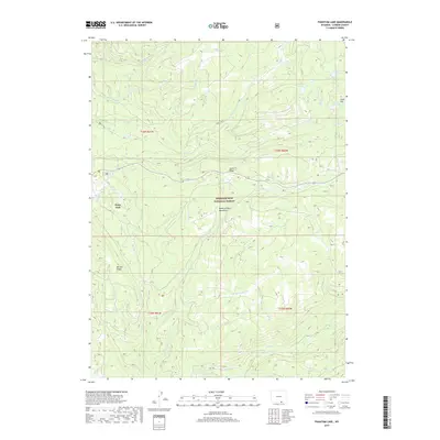
2017 Map of Phantom Lake
USGS Topo · Published 2017About this map
Medicine Bow National Forest encompasses this high-elevation landscape within the Medicine Bow Mountains of Carbon County. The small settlement of Ryan Park sits on the western edge of the quadrangle, serving as a gateway to the complex network of ridges and watercourses that define this area. Significant topographic features like Slash Ridge and Barrett Ridge divide the numerous drainages, including the North, Middle, and South forks of French Creek.
Find a feature on this map
29 named features on this map. Tap any name to fly to it.
Don’t see what you’re looking for? This feature index may not catch every label — zoom into the map to look around manually.
Map Details
Editions of this 2017 Phantom Lake Map
This is the sole edition of this map. No revisions or reprints were ever made.
Other maps of this area

1906 · Medicine Bow
USGS Topo · 1:125,000

1908 · Medicine Bow
USGS Topo · 1:125,000

1939 · Saratoga
USGS Topo · 1:125,000

1954 · Rawlins
USGS Topo · 1:250,000

1958 · Rawlins
USGS Topo · 1:250,000

1961 · Overlook Hill
USGS Topo · 1:24,000

1961 · Ryan Park
USGS Topo · 1:24,000

1961 · Sand Lake
USGS Topo · 1:24,000
1961 · Kennaday Peak
USGS Topo · 1:24,000

1961 · Medicine Bow Peak
USGS Topo · 1:24,000