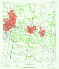
1963 Map of Pharr
USGS Topo · Published 1965About this map
The urban corridor of the Rio Grande Valley emerges in this mid-1960s study, anchored by McAllen, Pharr, and San Juan. The landscape reflects a transition from intensive agriculture to regional industrial and aviation hubs, centered on Miller International Airport and the surrounding network of irrigation and infrastructure. The map reveals the critical importance of water management in the region, dominated by the Main Floodway and the Hackney Lake Inlet, which bypasses the sprawling Pharr Gas Field and Hidalgo Gas Field.
Find a feature on this map
49 named features on this map. Tap any name to fly to it.
Don’t see what you’re looking for? This feature index may not catch every label — zoom into the map to look around manually.
Map Details
Editions of this 1963 Pharr Map
2 editions found
Other maps of this area

1914 · San Juan
USGS Topo · 1:48,000

1916 · San Juan
USGS Topo · 1:62,500

1940 · Monte Christo
USGS Topo · 1:62,500

1949 · Mc Allen
USGS Topo · 1:250,000

1954 · McAllen
USGS Topo · 1:250,000

1957 · Mc Allen
USGS Topo · 1:250,000

1962 · McAllen
USGS Topo · 1:250,000
1962 · San Juan SE
USGS Topo · 1:24,000
1962 · Las Milpas
USGS Topo · 1:24,000

1963 · Edinburg
USGS Topo · 1:24,000