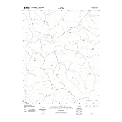
2010 Map of Phil
USGS Topo · Published 2010About this map
Green River and its various tributaries define the landscape of south-central Kentucky at the start of the 21st century. The terrain is a network of ridges and hollows, such as Hacker Ridge and Bruce Chapel Hollow, which have long dictated the placement of roads and homesteads. Small rural communities like Phil, Evona, and Teddy serve as local anchors, connected by winding routes like Jody Thomas Rd and S Fork Ridge Rd. Genealogists will find a wealth of local history in the numerous small burial grounds including Allen Cemetery and Russell Cemetery, often located near crossroads or church sites like Pumpkin Chapel. The map documents a traditional rural economy where water crossings, like Rubert Ford, and creek systems like Trace Fork and Luttrell Creek remain primary geographic landmarks.
Find a feature on this map
78 named features on this map. Tap any name to fly to it.
Don’t see what you’re looking for? This feature index may not catch every label — zoom into the map to look around manually.
Map Details
Editions of this 2010 Phil Map
This is the sole edition of this map. No revisions or reprints were ever made.
Other maps of this area

1952 · Clementsville
USGS Topo · 1:24,000

1952 · Liberty
USGS Topo · 1:24,000

1952 · Yosemite
USGS Topo · 1:24,000

1953 · Phil
USGS Topo · 1:24,000

1953 · Mintonville
USGS Topo · 1:24,000

1953 · Dunnville
USGS Topo · 1:24,000

1954 · Russell Springs
USGS Topo · 1:24,000

1954 · Eli
USGS Topo · 1:24,000
1954 · Faubush
USGS Topo · 1:24,000

1957 · Winchester
USGS Topo · 1:250,000