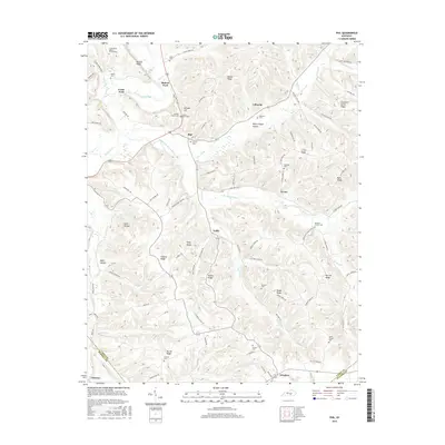
2016 Map of Phil
USGS Topo · Published 2016About this map
Phil serves as a central hub in this upland Kentucky landscape, situated where the South Fork Green River meets the Trace Fork. The terrain is defined by a dense network of high ridges and hollows, including Bluster Ridge, Hacker Ridge, and Burton Ridge, which dictate the winding paths of rural roads and the placement of small communities like Evona and Teddy. This survey documents a deeply established rural social structure, evidenced by the high density of family and community burial grounds such as the Jones Graveyard, Williams Cem, and Combast Cem. Historically significant crossings and gathering places are noted throughout, from Rubert Ford on the Green River to local religious landmarks like Antioch Church and Green River Valley Church. The southern portion of the map tracks the county line between Casey and Russell counties, where the settlement of Windsor straddles the boundary near the E Fork Goose Cr.
Find a feature on this map
104 named features on this map. Tap any name to fly to it.
Don’t see what you’re looking for? This feature index may not catch every label — zoom into the map to look around manually.
Map Details
Editions of this 2016 Phil Map
This is the sole edition of this map. No revisions or reprints were ever made.
Other maps of this area

1952 · Clementsville
USGS Topo · 1:24,000

1952 · Liberty
USGS Topo · 1:24,000

1952 · Yosemite
USGS Topo · 1:24,000

1953 · Phil
USGS Topo · 1:24,000

1953 · Mintonville
USGS Topo · 1:24,000

1953 · Dunnville
USGS Topo · 1:24,000

1954 · Russell Springs
USGS Topo · 1:24,000

1954 · Eli
USGS Topo · 1:24,000
1954 · Faubush
USGS Topo · 1:24,000

1957 · Winchester
USGS Topo · 1:250,000