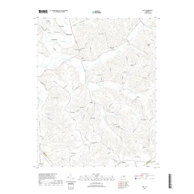
2019 Map of Phil
USGS Topo · Published 2019About this map
Green River and its South Fork drainage define this landscape of the south-central Kentucky knobs. The area is characterized by a dense network of family-named ridges and hollows, including Bluster Ridge, Hacker Ridge, and Polly Ridge, which separate small agricultural communities. Several significant family burial grounds and landmarks are documented here, such as the Antioch Graveyard and Carson Cem, which serve as vital touchstones for local genealogy.
Find a feature on this map
105 named features on this map. Tap any name to fly to it.
Don’t see what you’re looking for? This feature index may not catch every label — zoom into the map to look around manually.
Map Details
Editions of this 2019 Phil Map
This is the sole edition of this map. No revisions or reprints were ever made.
Other maps of this area

1952 · Clementsville
USGS Topo · 1:24,000

1952 · Liberty
USGS Topo · 1:24,000

1952 · Yosemite
USGS Topo · 1:24,000

1953 · Phil
USGS Topo · 1:24,000

1953 · Mintonville
USGS Topo · 1:24,000

1953 · Dunnville
USGS Topo · 1:24,000

1954 · Russell Springs
USGS Topo · 1:24,000

1954 · Eli
USGS Topo · 1:24,000
1954 · Faubush
USGS Topo · 1:24,000

1957 · Winchester
USGS Topo · 1:250,000