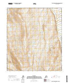
2017 Map of Philip Smith Mountains D-5 NW
USGS Topo · Published 2017About this map
The Kuparuk River flows northward through the eastern edge of this landscape in the Philip Smith Mountains. This interior region of the North Slope is defined by its drainage patterns and high-latitude topography, captured here in a 2017 survey that emphasizes the land's underlying structure through detailed contouring. The map area is organized by the Public Land Survey System grids of T5s R9e, T5s R10e, T6s R9e, and T6s R10e, which provide a formal framework for a territory devoid of permanent settlements or roads. The absence of human-made infrastructure or named landmarks beyond the river highlights the specialized nature of this Arctic environment, serving as a clean baseline for researchers and land managers monitoring this portion of the Alaskan wilderness.
Find a feature on this map
5 named features on this map. Tap any name to fly to it.
Don’t see what you’re looking for? This feature index may not catch every label — zoom into the map to look around manually.
Map Details
Editions of this 2017 Philip Smith Mountains D-5 NW Map
This is the sole edition of this map. No revisions or reprints were ever made.
Other maps of this area

1951 · Sagavanirktok D-5
USGS Topo · 1:250,000

1951 · Chandler Lake
USGS Topo · 1:250,000

1951 · Brooks
USGS Topo · 1:250,000

1952 · Umiat
USGS Topo · 1:250,000

1956 · Philip Smith Mountains
USGS Topo · 1:250,000

1956 · Chandler Lake
USGS Topo · 1:250,000

1956 · Sagavanirktok
USGS Topo · 1:250,000

1956 · Umiat
USGS Topo · 1:250,000

1958 · Sagavanirktok
USGS Topo · 1:250,000

1964 · Philip Smith Mountains
USGS Topo · 1:250,000