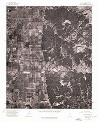
1974 Map of Philipp NE
USGS Topo · Published 1975About this map
Paynes serves as the primary landmark on this 1974 orthophoto quadrangle in Tallahatchie County. This photographic study captures a distinct transition in the Mississippi landscape, where the flat, grid-patterned agricultural fields of the Delta meet the more complex, timbered drainage systems to the east. The imagery reveals the intricate layout of rural property lines, farm roads, and the precise boundaries between cultivated land and woodlots at this specific moment in the mid-1970s. Because the map uses an orthophoto base instead of traditional line work, it provides a rare direct view of farmstead placements and localized land use centered around the Paynes community.
Find a feature on this map
1 named feature on this map. Tap any name to fly to it.
Don’t see what you’re looking for? This feature index may not catch every label — zoom into the map to look around manually.
Map Details
Editions of this 1974 Philipp NE Map
This is the sole edition of this map. No revisions or reprints were ever made.
Other maps of this area

1932 · Philipp
USGS Topo · 1:48,000

1935 · Crowder
USGS Topo · 1:62,500

1935 · Philipp
USGS Topo · 1:62,500

1939 · Crowder
USGS Topo · 1:62,500

1939 · Philipp
USGS Topo · 1:62,500

1948 · Helena
USGS Topo · 1:250,000

1950 · Helena
USGS Topo · 1:250,000

1953 · Greenwood
USGS Topo · 1:250,000

1953 · West Point
USGS Topo · 1:250,000

1954 · Grenada
USGS Topo · 1:62,500