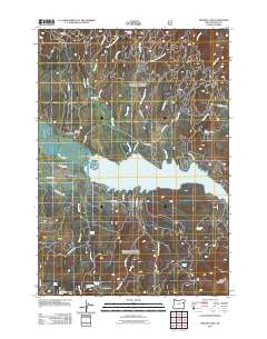
2011 Map of Phillips Lake
USGS Topo · Published 2011About this map
Phillips Lake dominates this Baker County landscape, its waters filling the central basin where the Powder River and Miners Creek converge. The settlement of McEwen sits just north of the lake's western reach, accompanied by the McEwen Cemetery and the broader expanse of Sumpter Valley. The map details a complex network of water management features, including the Farmers Ditch and the McEwen Valley Ditch, which underscore the region's agricultural history.
Find a feature on this map
46 named features on this map. Tap any name to fly to it.
Don’t see what you’re looking for? This feature index may not catch every label — zoom into the map to look around manually.
Map Details
Editions of this 2011 Phillips Lake Map
This is the sole edition of this map. No revisions or reprints were ever made.
Other maps of this area

1901 · Baker City
USGS Topo · 1:125,000

1901 · Sumpter
USGS Topo · 1:125,000

1955 · Baker
USGS Topo · 1:250,000

1955 · Canyon City
USGS Topo · 1:250,000

1959 · Baker
USGS Topo · 1:250,000

1959 · Canyon City
USGS Topo · 1:250,000

1967 · Blue Canyon
USGS Topo · 1:24,000
1967 · Wingville
USGS Topo · 1:24,000
1967 · Brannan Gulch
USGS Topo · 1:24,000
1972 · Elkhorn Peak
USGS Topo · 1:24,000