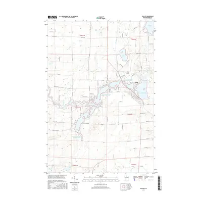
2015 Map of Phillips
USGS Topo · Published 2015About this map
Phillips serves as the focal point of this Northwoods landscape, situated along the complex shoreline of the Long Lakes and Wilson Flowage Duroy Elk. The town's grid is bounded by Lakeside Cem and the Price County Airport, while the surrounding Price County terrain is defined by an intricate network of water including Solberg Lake to the northeast and the Elk River winding through the center. This survey illustrates the modern transition from a wilderness-adjacent settlement to a recreational hub, where forest tracts are intersected by a dense web of secondary roads like Danish Settlement Rd and Crane Chase Rd. Noteworthy natural features such as Flemmings Rapids and the remote Janacek Springs suggest a landscape still deeply tied to its hydrologic roots, while the southern reaches of the quadrangle touch the N Fork Jump River.
Find a feature on this map
100 named features on this map. Tap any name to fly to it.
Don’t see what you’re looking for? This feature index may not catch every label — zoom into the map to look around manually.
Map Details
Editions of this 2015 Phillips Map
This is the sole edition of this map. No revisions or reprints were ever made.
Other maps of this area

1941 · Park Falls
USGS Topo · 1:48,000

1941 · Kennan
USGS Topo · 1:48,000

1941 · Kennedy
USGS Topo · 1:48,000

1941 · Phillips
USGS Topo · 1:48,000

1943 · Park Falls
USGS Topo · 1:48,000

1943 · Philliips
USGS Topo · 1:48,000

1945 · Kennedy
USGS Topo · 1:48,000

1945 · Kennan
USGS Topo · 1:48,000

1947 · Park Falls
USGS Topo · 1:48,000

1953 · Rice Lake
USGS Topo · 1:250,000