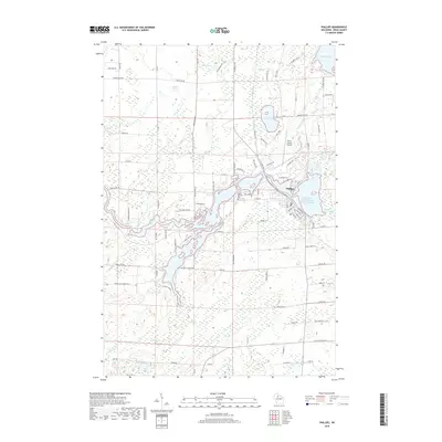
2018 Map of Phillips
USGS Topo · Published 2018About this map
The city of Phillips occupies the central eastern portion of this Price County landscape, positioned strategically among a complex network of waterways including the Elk River and the extensive Elk, Duroy, Long Lakes and Wilson Flowage. This 2018 survey reveals a terrain defined by its glacial heritage, characterized by numerous water bodies like the prominent Solberg Lake to the north and the smaller, more isolated Deer Lake and Lake Three. The local infrastructure is anchored by the Price County Airport and a grid of rural roads such as Mink Springs Rd and Danish Settlement Rd, which trace the history of regional land use. Genealogists and local historians will find significant detail in the mapping of Lakeside Cem and Saint Patricks Cem, while natural features like Janacek Springs and Flemmings Rapids suggest the area's ongoing importance for hydrology and recreation.
Find a feature on this map
97 named features on this map. Tap any name to fly to it.
Don’t see what you’re looking for? This feature index may not catch every label — zoom into the map to look around manually.
Map Details
Editions of this 2018 Phillips Map
This is the sole edition of this map. No revisions or reprints were ever made.
Other maps of this area

1941 · Park Falls
USGS Topo · 1:48,000

1941 · Kennan
USGS Topo · 1:48,000

1941 · Kennedy
USGS Topo · 1:48,000

1941 · Phillips
USGS Topo · 1:48,000

1943 · Park Falls
USGS Topo · 1:48,000

1943 · Philliips
USGS Topo · 1:48,000

1945 · Kennedy
USGS Topo · 1:48,000

1945 · Kennan
USGS Topo · 1:48,000

1947 · Park Falls
USGS Topo · 1:48,000

1953 · Rice Lake
USGS Topo · 1:250,000