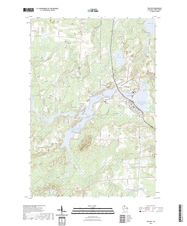
2023 Map of Phillips
USGS Topo · Published 2023About this map
Phillips sits at the heart of this Northwoods landscape, where the Elk River feeds a complex network of waterways including the Elk, Duroy, Long Lakes and Wilson Flowage. This 2023 edition highlights the county seat's layout, showing the concentrated civic center near the Price County Courthouse and the local transit hub at Price County Airport. The settlement pattern reflects its Northwoods orientation, with dense residential streets such as Chestnut St and S Avon Ave transitioning into rural tracts along Lake View Dr and Dama Rd.
Find a feature on this map
98 named features on this map. Tap any name to fly to it.
Don’t see what you’re looking for? This feature index may not catch every label — zoom into the map to look around manually.
Map Details
Editions of this 2023 Phillips Map
This is the sole edition of this map. No revisions or reprints were ever made.
Other maps of this area

1941 · Park Falls
USGS Topo · 1:48,000

1941 · Kennan
USGS Topo · 1:48,000

1941 · Kennedy
USGS Topo · 1:48,000

1941 · Phillips
USGS Topo · 1:48,000

1943 · Park Falls
USGS Topo · 1:48,000

1943 · Philliips
USGS Topo · 1:48,000

1945 · Kennedy
USGS Topo · 1:48,000

1945 · Kennan
USGS Topo · 1:48,000

1947 · Park Falls
USGS Topo · 1:48,000

1953 · Rice Lake
USGS Topo · 1:250,000