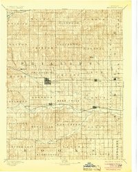
1893 Map of Phillipsburg
USGS Topo · Published 1904About this map
Phillipsburg serves as the central hub of this late nineteenth-century landscape, situated at a major crossing of the Chicago Rock Island and Pacific Railroad. The rail network defines the settlement patterns of the era, with towns like Agra, Kensington, and Stuttgart following the east-west corridor. To the south, the Missouri Pacific Railroad traces the path of the South Fork Solomon River, connecting the communities of Marvin and Kirwin. The map reveals a highly organized township system, with boundaries such as Arcade, Crystal, and Deer Creek overlaying a terrain marked by numerous small tributaries like Bissell Cr and Plotner Cr. Notable landmarks such as Blue Mound and the Big Bend of the river provide natural orientation points for local history researchers tracing the development of Phillips County and its neighbors.
Find a feature on this map
56 named features on this map. Tap any name to fly to it.
Don’t see what you’re looking for? This feature index may not catch every label — zoom into the map to look around manually.
Map Details
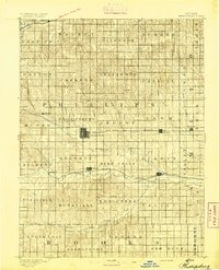
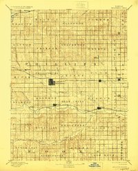
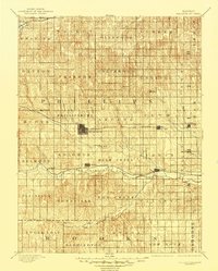
Editions of this 1893 Phillipsburg Map
4 editions found
Historical Maps of Phillipsburg Through Time
1 maps found