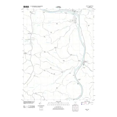
2010 Map of Philo
USGS Topo · Published 2010About this map
The Muskingum River dominates the eastern edge of this Muskingum County landscape, carving a path through a series of rugged hollows and high ridges. The area is defined by its small riverside settlements like Philo and Gaysport, which serve as local anchors along with the smaller hamlets of Merriam and Blue Rock. The terrain away from the river rises into distinctive landforms such as Butterbean Ridge, Irish Ridge, and Staker Ridge, reflecting a topography that has historically shaped local transport and agriculture. Numerous family and community burial grounds, including the Antioch Cemetery, Swingle Cemetery, and Saint Anns Cemetery, are scattered across the quadrangle. These sites, along with the Philo Post Office and Blue Rock Post Office, provide essential touchpoints for genealogical research and the study of rural Ohio community development in the early 21st century.
Find a feature on this map
97 named features on this map. Tap any name to fly to it.
Don’t see what you’re looking for? This feature index may not catch every label — zoom into the map to look around manually.
Map Details
Editions of this 2010 Philo Map
This is the sole edition of this map. No revisions or reprints were ever made.
Other maps of this area

1910 · Philo
USGS Topo · 1:62,500

1910 · Zanesville
USGS Topo · 1:62,500

1910 · Mc Connelsville
USGS Topo · 1:62,500

1911 · New Lexington
USGS Topo · 1:62,500

1947 · Columbus
USGS Topo · 1:250,000

1949 · Clarksburg
USGS Topo · 1:250,000

1956 · Clarksburg
USGS Topo · 1:250,000

1961 · Columbus
USGS Topo · 1:250,000

1961 · Clarksburg
USGS Topo · 1:250,000

1961 · Mc Connelsville
USGS Topo · 1:24,000