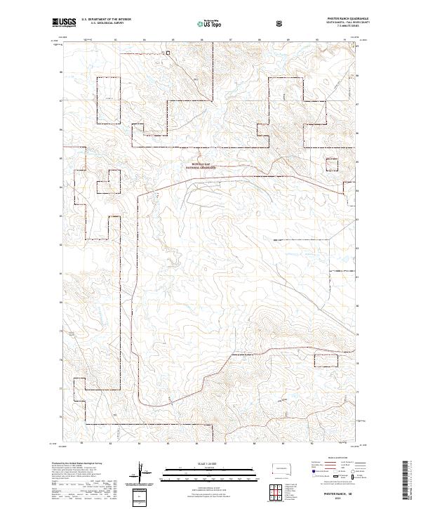
2021 Map of Phister Ranch
USGS Topo · Published 2021About this map
Buffalo Gap National Grassland dominates the central portion of this Fall River County survey, where the prairie is defined by a dense network of intermittent drainages. The landscape transitions from the open stretches of Coffee Flats to the complex creek systems of Cottonwood Cr, Alum Cr, and Little Cottonwood Cr. This area of southwestern South Dakota maintains a low-density ranching character, centered on landmarks like the Phister Ranch. The infrastructure is minimal, consisting primarily of section-line roads and routes such as Co HWY 8 and TWP RD 7007. The hydrology of the region is traced through numerous draws and creeks, including Softwater Cr, Buck Draw, and Coyote Cr, which illustrate the natural drainage patterns of the Great Plains.
Find a feature on this map
19 named features on this map. Tap any name to fly to it.
Don’t see what you’re looking for? This feature index may not catch every label — zoom into the map to look around manually.
Map Details
Editions of this 2021 Phister Ranch Map
This is the sole edition of this map. No revisions or reprints were ever made.
Other maps of this area

1902 · Edgemont
USGS Topo · 1:125,000

1950 · Edgemont
USGS Topo · 1:24,000

1950 · Edgemont SW
USGS Topo · 1:24,000

1955 · Hot Springs
USGS Topo · 1:250,000

1955 · Newcastle
USGS Topo · 1:250,000

1958 · Newcastle
USGS Topo · 1:250,000

1978 · Coffee Flats
USGS Topo · 1:24,000
1978 · Oat Creek
USGS Topo · 1:24,000
1978 · Mule Creek SE
USGS Topo · 1:24,000

1981 · Lance Creek
USGS Topo · 1:100,000