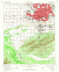
1952 Map of Phoenix
USGS Topo · Published 1968About this map
Phoenix and its mid-century periphery emerge during a period of significant post-war expansion, bounded to the south by the rugged South Mountain Park and the Phoenix Proving Grounds. The map illustrates a transitional landscape where established agricultural networks, defined by the Grand Canal and Buckeye Canal, meet the growing urban grid. South of the city, indigenous communities and rural outposts like Komatke, Gila Crossing, and St Johns Indian Sch sit near the confluence of the Salt River and Gila River. The presence of numerous specialized institutions, from the Phoenix Police Academy to the State Capitol, reflects the city's role as a growing administrative hub. Local genealogy is supported by the identification of community landmarks like Isaac Cem and several schools serving neighborhood developments, including Osborn Sch and Creighton Sch.
Find a feature on this map
75 named features on this map. Tap any name to fly to it.
Don’t see what you’re looking for? This feature index may not catch every label — zoom into the map to look around manually.
Map Details
Editions of this 1952 Phoenix Map
2 editions found

Other maps of this area

1904 · Camelback
USGS Topo · 1:62,500

1906 · Camelsback
USGS Topo · 1:62,500

1912 · Phoenix
USGS Topo · 1:62,500

1913 · Mesa
USGS Topo · 1:62,500

1913 · Maricopa
USGS Topo · 1:62,500

1914 · Gila Butte
USGS Topo · 1:62,500

1914 · Phoenix
USGS Topo · 1:62,500

1915 · Mesa
USGS Topo · 1:62,500

1915 · Maricopa
USGS Topo · 1:62,500

1917 · Gila Butte
USGS Topo · 1:62,500