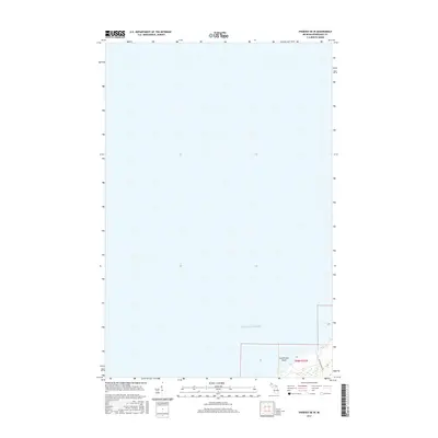
2017 Map of Phoenix OE W
USGS Topo · Published 2017About this map
Lake Superior dominates this portion of the Keweenaw Peninsula coastline, where the land meets the cold waters of the world's largest freshwater lake. This 2017 survey captures a section of Allouez Township characterized by its shoreline and underwater topography, specifically the Hutchinson Shoal located just offshore. Navigation along this rugged stretch is marked by the presence of this shoal, a critical feature for maritime safety. On land, the network of human movement is represented primarily by Five Mile Point Rd, which skirts the coast through Township 58 North, Range 32 West. The map reveals a landscape defined by the transition from terrestrial forests to the vast expanse of the lake, with little development beyond the peripheral road infrastructure.
Find a feature on this map
4 named features on this map. Tap any name to fly to it.
Don’t see what you’re looking for? This feature index may not catch every label — zoom into the map to look around manually.
Map Details
Editions of this 2017 Phoenix OE W Map
This is the sole edition of this map. No revisions or reprints were ever made.
Other maps of this area

1941 · Ahmeek
USGS Topo · 1:31,680

1941 · Mohawk
USGS Topo · 1:31,680

1946 · Phoenix
USGS Topo · 1:24,000

1946 · Mohawk
USGS Topo · 1:24,000

1946 · Muggun Creek
USGS Topo · 1:24,000

1946 · Ahmeek
USGS Topo · 1:24,000

1947 · Phoenix
USGS Topo · 1:24,000

1947 · Ahmeek
USGS Topo · 1:24,000
1948 · Muggun Creek
USGS Topo · 1:24,000
1948 · Mohawk
USGS Topo · 1:24,000