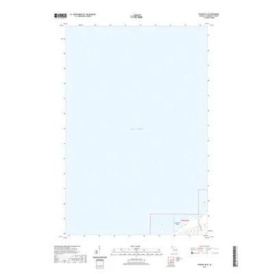
2019 Map of Phoenix OE W
USGS Topo · Published 2019About this map
Lake Superior dominates this northern maritime perspective of the Keweenaw Peninsula, where the vast cold waters meet a sliver of the Michigan coastline. This area is characterized by underwater hazards such as Hutchinson Shoal, located just off the shoreline in the southern portion of the quadrangle. On land, the infrastructure is sparse, reflecting the remote character of Allouez Township. The landscape is oriented around Five Mile Point Rd, which skirts the coast and provides the primary terrestrial link to this stretch of the peninsula. The survey highlights the intersection of Township 58 North and Range 32 West, illustrating a point where the rugged Lake Superior shoreline dictates the layout of local roads and land divisions.
Find a feature on this map
4 named features on this map. Tap any name to fly to it.
Don’t see what you’re looking for? This feature index may not catch every label — zoom into the map to look around manually.
Map Details
Editions of this 2019 Phoenix OE W Map
This is the sole edition of this map. No revisions or reprints were ever made.
Other maps of this area

1941 · Ahmeek
USGS Topo · 1:31,680

1941 · Mohawk
USGS Topo · 1:31,680

1946 · Phoenix
USGS Topo · 1:24,000

1946 · Mohawk
USGS Topo · 1:24,000

1946 · Muggun Creek
USGS Topo · 1:24,000

1946 · Ahmeek
USGS Topo · 1:24,000

1947 · Phoenix
USGS Topo · 1:24,000

1947 · Ahmeek
USGS Topo · 1:24,000
1948 · Muggun Creek
USGS Topo · 1:24,000
1948 · Mohawk
USGS Topo · 1:24,000