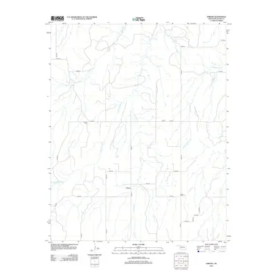
2012 Map of Phroso
USGS Topo · Published 2012About this map
Phroso sits at the center of this rural Oklahoma landscape, where the headwaters of the Griever and Barney creek systems carve their way through the terrain. The settlement pattern is defined by a strictly organized sectional road grid, including N2350 Rd and E0505 Rd, which serves a series of isolated cemeteries that hint at the area's long-standing community roots. Genealogists will find interest in the dispersed burial grounds like Golden Lodge Cem, Antioch Cem, and Mt Zion Cem, which are spaced several miles apart across the territory.
Find a feature on this map
30 named features on this map. Tap any name to fly to it.
Don’t see what you’re looking for? This feature index may not catch every label — zoom into the map to look around manually.
Map Details
Editions of this 2012 Phroso Map
This is the sole edition of this map. No revisions or reprints were ever made.
Other maps of this area

1955 · Woodward
USGS Topo · 1:250,000

1958 · Woodward
USGS Topo · 1:250,000

1969 · Phroso
USGS Topo · 1:24,000

1969 · Belva
USGS Topo · 1:24,000

1969 · Glass Mountains NW
USGS Topo · 1:24,000

1969 · Cedardale
USGS Topo · 1:24,000

1969 · Togo
USGS Topo · 1:24,000

1969 · Glass Mountains SW
USGS Topo · 1:24,000

1972 · Canton NW
USGS Topo · 1:24,000

1972 · Seiling
USGS Topo · 1:24,000