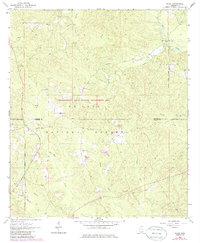
1964 Map of Piave
USGS Topo · Published 1986About this map
De Soto National Forest and the Chickasawhay State Wildlife Management Area dominate this landscape on the border of Wayne and Greene counties. The settlement of Piave sits in the southwest corner near Granny Creek, while Smithtown is situated further north along the local road network. This mid-century survey reflects a rural Mississippi timber and wildlife region, marked by strategic observation points like the Piney Woods Lookout Tower and Stony Lookout Tower.
Find a feature on this map
26 named features on this map. Tap any name to fly to it.
Don’t see what you’re looking for? This feature index may not catch every label — zoom into the map to look around manually.
Map Details
Editions of this 1964 Piave Map
4 editions found
Other maps of this area

1953 · Hattiesburg
USGS Topo · 1:250,000

1958 · Hattiesburg
USGS Topo · 1:250,000

1963 · Brewer
USGS Topo · 1:24,000

1964 · Knobtown
USGS Topo · 1:24,000

1964 · Clark
USGS Topo · 1:24,000

1964 · Clara
USGS Topo · 1:24,000

1964 · Mulberry
USGS Topo · 1:24,000

1964 · Buckatunna
USGS Topo · 1:24,000

1964 · Avera
USGS Topo · 1:24,000

1964 · Piave
USGS Topo · 1:24,000