
1947 Map of Picacho Butte
USGS Topo · Published 1958About this map
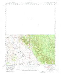
Prescott National Forest dominates the eastern half of this terrain, while the western landscape is defined by the broad drainage of Chino Wash. Ranching and water management are the primary themes of this mid-century survey, with family-named operations like CV Ranch, Fritsche Ranch, and the K4 Farm established near the seasonal watercourses. The infrastructure of the high desert is visible through numerous windmills and small-scale water improvements such as Cotton Dam and Mexican Dam. Industrial activity is represented by the Stone Quarry north of South Butte, while the northern portion of the map remains labeled as an Unsurveyed Area, reflecting the transition from managed forest land to open, unmapped territory during the late 1940s.
Find a feature on this map
24 named features on this map. Tap any name to fly to it.
Don’t see what you’re looking for? This feature index may not catch every label — zoom into the map to look around manually.
Map Details
Editions of this 1947 Picacho Butte Map
2 editions found
Other maps of this area

1886 · Chino
USGS Topo · 1:250,000

1887 · Prescott
USGS Topo · 1:250,000

1891 · Chino
USGS Topo · 1:250,000

1892 · Prescott
USGS Topo · 1:250,000

1905 · Jerome
USGS Topo · 1:125,000

1922 · Williams
USGS Topo · 1:125,000

1947 · Ash Fork
USGS Topo · 1:62,500

1947 · Simmons
USGS Topo · 1:62,500

1947 · Paulden
USGS Topo · 1:62,500

1947 · Turkey Canyon
USGS Topo · 1:62,500