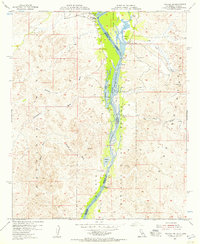
1954 Map of Picacho NW
USGS Topo · Published 1957About this map
The Colorado River serves as a winding lifeblood for this borderland during the mid-1950s, defining the boundary between California and Arizona within the Imperial National Wildlife Refuge. The riparian landscape is marked by a string of oxbows and backwaters, including Cibola Lake, Walker Lake, and Draper Lake, which contrast sharply with the surrounding desert terrain. Evidence of earlier river-based commerce and settlement appears at Paymaster Landing (Site) and the Clip Mill (Site), points where the river once met the needs of remote prospectors and travelers.
Find a feature on this map
25 named features on this map. Tap any name to fly to it.
Don’t see what you’re looking for? This feature index may not catch every label — zoom into the map to look around manually.
Map Details
Editions of this 1954 Picacho NW Map
2 editions found
Other maps of this area

1942 · Blythe
USGS Topo · 1:250,000

1945 · Cibola
USGS Topo · 1:62,500

1945 · Picacho
USGS Topo · 1:62,500

1951 · Picacho
USGS Topo · 1:62,500

1951 · Cibola
USGS Topo · 1:62,500

1953 · Palo Verde Mountains
USGS Topo · 1:62,500

1953 · Quartz Peak
USGS Topo · 1:62,500

1954 · Salton Sea
USGS Topo · 1:250,000
1954 · Picacho NW
USGS Topo · 1:24,000
1954 · Picacho SW
USGS Topo · 1:24,000