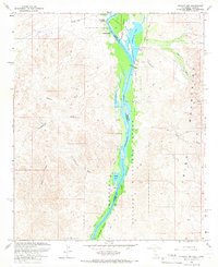
1965 Map of Picacho NW
USGS Topo · Published 1966About this map
The Colorado River forms the central spine of this mid-century survey, defining the border between California and Arizona as it flows through the Cibola Valley. This stretch of the river is characterized by a complex network of backwaters and wetlands, protected by the Cibola National Wildlife Refuge. Numerous water bodies including Three Finger Lake, Cibola Lake, and Walker Lake are visible along the river's path, highlighting the dynamic hydrology of the region before modern diversions fully altered these landscapes.
Find a feature on this map
26 named features on this map. Tap any name to fly to it.
Don’t see what you’re looking for? This feature index may not catch every label — zoom into the map to look around manually.
Map Details
Editions of this 1965 Picacho NW Map
2 editions found
Other maps of this area

1942 · Blythe
USGS Topo · 1:250,000

1945 · Cibola
USGS Topo · 1:62,500

1945 · Picacho
USGS Topo · 1:62,500

1951 · Picacho
USGS Topo · 1:62,500

1951 · Cibola
USGS Topo · 1:62,500

1953 · Palo Verde Mountains
USGS Topo · 1:62,500

1953 · Quartz Peak
USGS Topo · 1:62,500

1954 · Salton Sea
USGS Topo · 1:250,000
1954 · Picacho NW
USGS Topo · 1:24,000
1954 · Picacho SW
USGS Topo · 1:24,000