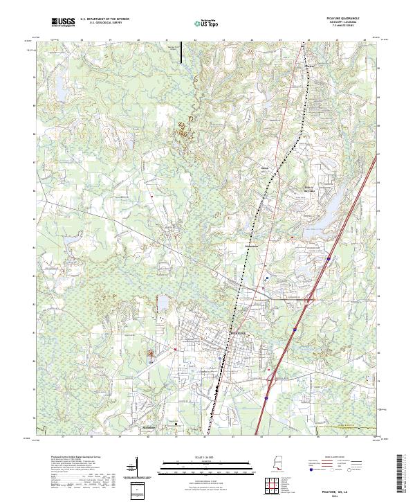
2024 Map of Picayune
USGS Topo · Published 2024About this map
Picayune and its surrounding communities in Pearl River County are documented here during a period of modern residential development and managed natural spaces. The landscape is defined by the convergence of the West Hobolochitto Creek and East Hobolochitto Creek, which navigate through the piney woods of southern Mississippi. Significant civic landmarks include the Pearl River County Governmental Complex and the Thigpen Cem near Nicholson, reflecting the region's long-term settlement patterns.
Find a feature on this map
241 named features on this map. Tap any name to fly to it.
Don’t see what you’re looking for? This feature index may not catch every label — zoom into the map to look around manually.
Map Details
Editions of this 2024 Picayune Map
This is the sole edition of this map. No revisions or reprints were ever made.
Other maps of this area

1914 · Nicholson
USGS Topo · 1:62,500

1921 · Nicholson
USGS Topo · 1:62,500

1935 · Slidell
USGS Topo · 1:62,500

1939 · Slidell
USGS Topo · 1:62,500

1941 · Honey Island
USGS Topo · 1:31,680

1942 · Walkiah Bluff
USGS Topo · 1:31,680

1942 · Pools Bluff
USGS Topo · 1:31,680

1950 · Slidell
USGS Topo · 1:62,500

1953 · Mobile
USGS Topo · 1:250,000

1955 · Nicholson
USGS Topo · 1:24,000