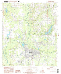
1997 Map of Picayune
USGS Topo · Published 1999About this map
The city of Picayune serves as the focal point of this late-twentieth-century landscape, situated where the West Hobolochitto Creek and East Hobolochitto Creek converge. The town's growth is evident in its street grid and the presence of the Municipal Airport to the southwest. Nearby residential developments like Hide-A-Way Lake reflect the area's mid-century and later expansion beyond its original rail-and-timber roots.
Find a feature on this map
29 named features on this map. Tap any name to fly to it.
Don’t see what you’re looking for? This feature index may not catch every label — zoom into the map to look around manually.
Map Details
Editions of this 1997 Picayune Map
This is the sole edition of this map. No revisions or reprints were ever made.
Other maps of this area

1914 · Nicholson
USGS Topo · 1:62,500

1921 · Nicholson
USGS Topo · 1:62,500

1935 · Slidell
USGS Topo · 1:62,500

1939 · Slidell
USGS Topo · 1:62,500

1941 · Honey Island
USGS Topo · 1:31,680

1942 · Walkiah Bluff
USGS Topo · 1:31,680

1942 · Pools Bluff
USGS Topo · 1:31,680

1950 · Slidell
USGS Topo · 1:62,500

1953 · Mobile
USGS Topo · 1:250,000

1955 · Nicholson
USGS Topo · 1:24,000