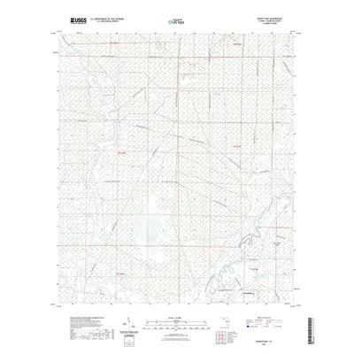
2021 Map of Pickett Bay
USGS Topo · Published 2021About this map
The coastal wetlands and pine flatwoods of Franklin County dominate this 2021 landscape, where the New River and Crooked River converge near the Gulf of Mexico. The town of Carrabelle occupies the southeastern corner, serving as a gateway to the intricate waterway system that includes Pickett Bay and the sprawling Saint James Island. This modern survey reveals a landscape largely managed for conservation and recreation, defined by the extensive network of the Tates Hell State Forest Trl and the Florida Circumnavigational Paddling Trl threading through the swamps. Inland features like Thousand Yard Bay, Waldon Lake, and Cypress Slough highlight the low-lying, water-dependent geography of the region. Local infrastructure such as Saw Bluff, Mill Pond, and numerous forest roads like Gully Branch Rd provide critical points of orientation for those studying the contemporary layout of this historic timber and fishing territory.
Find a feature on this map
46 named features on this map. Tap any name to fly to it.
Don’t see what you’re looking for? This feature index may not catch every label — zoom into the map to look around manually.
Map Details
Editions of this 2021 Pickett Bay Map
This is the sole edition of this map. No revisions or reprints were ever made.
Other maps of this area

1943 · Dog Island
USGS Topo · 1:31,680

1943 · Carrabelle
USGS Topo · 1:24,000

1944 · Pickett Bay
USGS Topo · 1:31,680

1944 · Carrabelle
USGS Topo · 1:31,680

1944 · Green Point
USGS Topo · 1:31,680

1945 · Thousand Yard Bay
USGS Topo · 1:31,680

1945 · Tates Hell Swamp
USGS Topo · 1:31,680

1945 · Mc Intyre
USGS Topo · 1:31,680

1945 · Pickett Bay
USGS Topo · 1:31,680

1945 · Sanborn
USGS Topo · 1:31,680