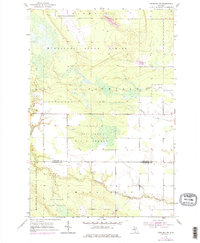
1953 Map of Pickford NW
USGS Topo · Published 1977About this map
Kincheloe Air Force Base dominates the northern landscape of this region, reflecting the Cold War-era expansion of military infrastructure across the Upper Peninsula. To the south, the terrain transitions into the dense, managed woodlands of the Munuscong State Forest and the Hiawatha National Forest. This 1953 survey, which includes updates from 1975, tracks the intricate hydrology of the Munuscong River and its tributaries, including Parker Creek and Fletcher Creek. The presence of the Cottle Cem near the boundary of Chippewa Co and Mackinac Co provides a tangible point of reference for genealogists researching family ties in this corner of Marquette and Pickford. The map also documents local industry through several Gravel Pits scattered near the river valley, marking the modest extraction activities that supported the area's development.
Find a feature on this map
12 named features on this map. Tap any name to fly to it.
Don’t see what you’re looking for? This feature index may not catch every label — zoom into the map to look around manually.
Map Details
Editions of this 1953 Pickford NW Map
3 editions found
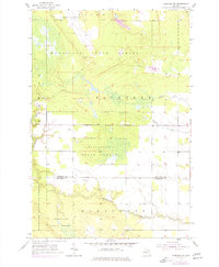
Other maps of this area

1913 · Sault Sainte Marie
USGS Topo · 1:62,500

1931 · Pickford SE
USGS Topo · 1:31,680

1941 · Sault Sainte Marie
USGS Topo · 1:63,360

1941 · Brimley
USGS Topo · 1:63,360

1951 · Kinross
USGS Topo · 1:24,000

1951 · Dafter
USGS Topo · 1:24,000

1951 · Barbeau
USGS Topo · 1:24,000

1951 · Brimley
USGS Topo · 1:62,500

1951 · Sault Ste. Marie
USGS Topo · 1:62,500

1953 · Pickford NW
USGS Topo · 1:24,000
Featured Places
- Marquette Township, MI
- Pickford Township, MI
- Rudyard Township, MI
- Kinross Township, MI
- Chippewa County, MI