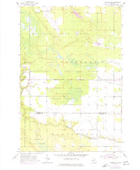
1953 Map of Pickford NW
USGS Topo · Published 1977About this map
Munuscong State Forest dominates the landscape of this northern Michigan territory, where the topography is defined by the winding Munuscong River and its tributaries, Parker Creek and Fletcher Creek. The presence of the Kincheloe Air Force Base in the north indicates the strategic military footprint in the Eastern Upper Peninsula during the mid-20th century. Local history and genealogy are anchored by features like Cottle Cem, located near the border of Chippewa and Mackinac counties. The map also captures the area's industrial leanings through several Gravel Pits and borrow pits scattered across the terrain. Large swaths of the Hiawatha National Forest border the southern reaches, highlighting the transition from public timberlands to active military and resource extraction zones.
Find a feature on this map
11 named features on this map. Tap any name to fly to it.
Don’t see what you’re looking for? This feature index may not catch every label — zoom into the map to look around manually.
Map Details
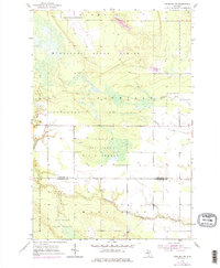
Editions of this 1953 Pickford NW Map
3 editions found
Other maps of this area

1913 · Sault Sainte Marie
USGS Topo · 1:62,500

1931 · Pickford SE
USGS Topo · 1:31,680

1941 · Sault Sainte Marie
USGS Topo · 1:63,360

1941 · Brimley
USGS Topo · 1:63,360

1951 · Kinross
USGS Topo · 1:24,000

1951 · Dafter
USGS Topo · 1:24,000

1951 · Barbeau
USGS Topo · 1:24,000

1951 · Brimley
USGS Topo · 1:62,500

1951 · Sault Ste. Marie
USGS Topo · 1:62,500

1953 · Pickford NW
USGS Topo · 1:24,000
Featured Places
- Marquette Township, MI
- Pickford Township, MI
- Rudyard Township, MI
- Kinross Township, MI
- Chippewa County, MI