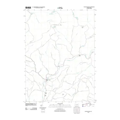
2010 Map of Picture Rocks
USGS Topo · Published 2010About this map
Muncy Creek serves as the primary drainage and central artery for this portion of Lycoming County, winding past several established settlements. The borough of Picture Rocks sits in the lower valley, while the communities of Glen Mawr and Tivoli are situated further upstream. The map illustrates a landscape where small valley communities are connected by narrow roads winding through the local hills, such as Taylor Hill Rd and Foust Hill Rd.
Find a feature on this map
71 named features on this map. Tap any name to fly to it.
Don’t see what you’re looking for? This feature index may not catch every label — zoom into the map to look around manually.
Map Details
Editions of this 2010 Picture Rocks Map
This is the sole edition of this map. No revisions or reprints were ever made.
Other maps of this area

1924 · Milton
USGS Topo · 1:62,500

1927 · Eagles Mere
USGS Topo · 1:48,000

1930 · Warrensville
USGS Topo · 1:62,500

1932 · Eagle Mere
USGS Topo · 1:62,500

1934 · Warrensville
USGS Topo · 1:62,500

1935 · Hughesville
USGS Topo · 1:62,500

1953 · Hughesville
USGS Topo · 1:62,500

1953 · Warrensville
USGS Topo · 1:62,500

1953 · Eagles Mere
USGS Topo · 1:62,500

1953 · Milton
USGS Topo · 1:62,500
Featured Places
- Picture Rocks, PA
- Hillsgrove Township, PA
- Tivoli, Shrewsbury Township
- Bryan Mill, Wolf Township
- Villa Grove, Wolf Township