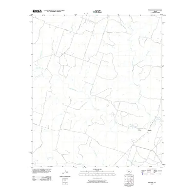
2010 Map of Pidcoke
USGS Topo · Published 2010About this map
Pidcoke and Slater anchor this rural Coryell County landscape, where ranch roads and state highways intersect a complex network of waterways. The settlement at Pidcoke is situated near the confluence of Bee House Creek and Cowhouse Creek, a point where FM 116 and FM 580 converge. The presence of the Pidcoke Cemetery provides a focal point for genealogical interest in this part of Central Texas. To the northwest, the small community of Slater sits along FM 1783, surrounded by named drainages such as Patterson Branch and North Bee House Creek. The map details a transition from these primary settlements into more dispersed ranchland, marked by numerous local routes like King Ranch Rd and Table Rock Rd that trace the undulating terrain between Perryman Creek and Buttermilk Creek.
Find a feature on this map
40 named features on this map. Tap any name to fly to it.
Don’t see what you’re looking for? This feature index may not catch every label — zoom into the map to look around manually.
Map Details
Editions of this 2010 Pidcoke Map
This is the sole edition of this map. No revisions or reprints were ever made.
Other maps of this area

1887 · Lampasas
USGS Topo · 1:125,000

1894 · Lampasas
USGS Topo · 1:125,000

1894 · Gatesville
USGS Topo · 1:125,000

1947 · Fort Hood
USGS Topo · 1:62,500

1947 · Fort Hood
USGS Topo · 1:24,000

1947 · Purmela
USGS Topo · 1:62,500

1947 · Gatesville West
USGS Topo · 1:24,000

1947 · Pidcoke
USGS Topo · 1:24,000

1947 · Purmela
USGS Topo · 1:24,000

1947 · Shell Mountains
USGS Topo · 1:24,000