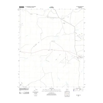
2010 Map of Pie Town
USGS Topo · Published 2010About this map
Pie Town serves as the primary settlement on this high-altitude plateau, situated along the Continental Divide near the unique geographic marker Top of the World. The community structure is defined by its essential civic landmarks, including the Pie Town Post Office and the Pie Town Cemetery, while local transportation and ranching operations are supported by the Nalda Ranch Airport to the north.
Find a feature on this map
26 named features on this map. Tap any name to fly to it.
Don’t see what you’re looking for? This feature index may not catch every label — zoom into the map to look around manually.
Map Details
Editions of this 2010 Pie Town Map
This is the sole edition of this map. No revisions or reprints were ever made.
Other maps of this area

1954 · Saint Johns
USGS Topo · 1:250,000

1957 · Saint Johns
USGS Topo · 1:250,000

1958 · Saint Johns
USGS Topo · 1:250,000

1962 · Saint Johns
USGS Topo · 1:250,000

1967 · Omega
USGS Topo · 1:24,000
1967 · Tres Lagunas
USGS Topo · 1:24,000
1967 · Red Flats
USGS Topo · 1:24,000

1967 · Adams Diggings
USGS Topo · 1:24,000

1967 · Blue Hills
USGS Topo · 1:24,000
1967 · Pie Town
USGS Topo · 1:24,000