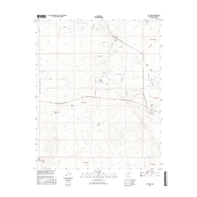
2017 Map of Pie Town
USGS Topo · Published 2017About this map
Pie Town sits at a high-elevation crossroads in Catron County, defined by its position along the Continental Divide National Scenic Trail. This 2017 survey reveals the distinct drainage patterns of the region, where numerous draws like McAllister Draw and Chavez Draw carve into the high desert landscape. The presence of the Nalda Ranch Airport and the high point labeled Top of the World emphasize the aerial and topographical prominence of this Continental Divide community. Locally significant sites including the Pie Town Cem and water features like Santianez Lake and the Tres Lagunas ponds provide clear markers for genealogists and local historians tracking the modern footprint of this unique settlement. The map also details a network of named tracks and trails, such as Old Stage Rd and Sawtooth TRL, which trace the transit history of the area.
Find a feature on this map
50 named features on this map. Tap any name to fly to it.
Don’t see what you’re looking for? This feature index may not catch every label — zoom into the map to look around manually.
Map Details
Editions of this 2017 Pie Town Map
This is the sole edition of this map. No revisions or reprints were ever made.
Other maps of this area

1954 · Saint Johns
USGS Topo · 1:250,000

1957 · Saint Johns
USGS Topo · 1:250,000

1958 · Saint Johns
USGS Topo · 1:250,000

1962 · Saint Johns
USGS Topo · 1:250,000
1967 · Omega
USGS Topo · 1:24,000
1967 · Tres Lagunas
USGS Topo · 1:24,000
1967 · Red Flats
USGS Topo · 1:24,000
1967 · Adams Diggings
USGS Topo · 1:24,000
1967 · Blue Hills
USGS Topo · 1:24,000
1967 · Pie Town
USGS Topo · 1:24,000