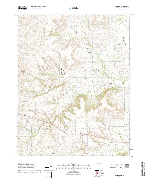
2022 Map of Piedmont NW
USGS Topo · Published 2022About this map
Blodgett sits at the southern edge of this landscape in Greenwood County, where the plains give way to the dissected terrain of the Flint Hills region. The area is defined by the branching drainages of the Otter Creek system, including N Br Otter Cr and S Br Otter Cr, which create a complex network of ridges and draws. On one such high point, Temple Knob stands as a prominent local landmark, while the Star Cem remains a quiet fixture of the rural community near Star Rd. The map reveals a strictly regulated township and range grid system, with roads like 90th St and Glasco Rd following section lines despite the undulating topography. This persistent grid, alongside named local routes like Beedle Dr and Junkyard Hill Rd, reflects the enduring intersection of agricultural land management and the natural flow of the Kansas prairie.
Find a feature on this map
37 named features on this map. Tap any name to fly to it.
Don’t see what you’re looking for? This feature index may not catch every label — zoom into the map to look around manually.
Map Details
Editions of this 2022 Piedmont NW Map
This is the sole edition of this map. No revisions or reprints were ever made.
Other maps of this area

1885 · Eureka
USGS Topo · 1:125,000

1888 · Eureka
USGS Topo · 1:125,000

1888 · Eldorado
USGS Topo · 1:125,000

1894 · Eureka
USGS Topo · 1:125,000

1955 · Wichita
USGS Topo · 1:250,000

1958 · Wichita
USGS Topo · 1:250,000

1961 · Rosalia
USGS Topo · 1:24,000
1964 · Piedmont SW
USGS Topo · 1:24,000

1964 · Piedmont NW
USGS Topo · 1:24,000

1964 · Beaumont
USGS Topo · 1:24,000