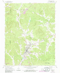
1968 Map of Piedmont
USGS Topo · Published 1985About this map
Piedmont serves as the primary hub in this late 1960s survey, showing the town's concentration of industry and infrastructure along the Missouri Pacific railroad. The landscape is defined by the Ozark foothills, where narrow hollows and creek bottoms provided the only level ground for cemeteries like Ruble Cemetery and Williams Cemetery. The map captures a moment of mid-century development, recording a Drive-in Theater and the local Radio Tower (KPWB) alongside older rural landmarks like Beulah Church and Peachtree Church. To the north, the small settlement of Gads Hill marks a point of historical interest near the rugged terrain of Grassy Mountain. Several active Quarries and a Quarry near Lon Sanders Canyon indicate the area's continued reliance on stone extraction and the local geology.
Find a feature on this map
49 named features on this map. Tap any name to fly to it.
Don’t see what you’re looking for? This feature index may not catch every label — zoom into the map to look around manually.
Map Details
Editions of this 1968 Piedmont Map
2 editions found
Other maps of this area

1926 · Des Arc
USGS Topo · 1:62,500

1929 · Des Arc
USGS Topo · 1:62,500

1932 · Piedmont
USGS Topo · 1:62,500

1935 · Piedmont
USGS Topo · 1:62,500

1943 · Ellington
USGS Topo · 1:62,500

1943 · Lesterville
USGS Topo · 1:62,500

1945 · Ellington
USGS Topo · 1:62,500

1946 · Lesterville
USGS Topo · 1:62,500

1949 · Rolla
USGS Topo · 1:250,000

1953 · Rolla
USGS Topo · 1:250,000