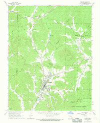
1968 Map of Piedmont
USGS Topo · Published 1969About this map
Piedmont serves as the focal point of this late 1960s Ozark landscape, where the Missouri Pacific railroad corridor dictates the settlement pattern through the river valley. The town's mid-century infrastructure is well-defined, featuring the Piedmont Memorial Airport, a Substation, and even a Drive-in Theater situated east of the main town site. Just to the south, the smaller community of Beckville sits near the McKenzie Creek floodplain, illustrating the tight relationship between topography and town development in this part of Benton township.
Find a feature on this map
46 named features on this map. Tap any name to fly to it.
Don’t see what you’re looking for? This feature index may not catch every label — zoom into the map to look around manually.
Map Details
Editions of this 1968 Piedmont Map
2 editions found
Other maps of this area

1926 · Des Arc
USGS Topo · 1:62,500

1929 · Des Arc
USGS Topo · 1:62,500

1932 · Piedmont
USGS Topo · 1:62,500

1935 · Piedmont
USGS Topo · 1:62,500

1943 · Ellington
USGS Topo · 1:62,500

1943 · Lesterville
USGS Topo · 1:62,500

1945 · Ellington
USGS Topo · 1:62,500

1946 · Lesterville
USGS Topo · 1:62,500

1949 · Rolla
USGS Topo · 1:250,000

1953 · Rolla
USGS Topo · 1:250,000