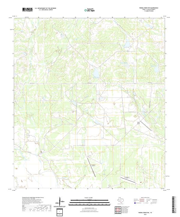
2022 Map of Piedra Creek NW
USGS Topo · Published 2022About this map
Large ranching tracts and private aviation facilities define this landscape in the northern brush country of La Salle County. The terrain is characterized by intermittent drainage systems including Sauz Cr and Piedra Cr, which feed several named stock tanks and reservoirs essential for local cattle operations. Features such as Welder Lake Number 6 and Cameron Ranch Lake Number 4 illustrate the importance of water management in this arid region. The map reveals a network of private infrastructure, most notably the several landing strips including Morris Ranch Airport, El Caballero Airport, and Ghost Apache Airport, reflecting the logistical needs of sprawling Texas ranch holdings. Connectivity across these vast properties is maintained by routes like Ranch Rd 624 and Herradura Ranch Rd.
Find a feature on this map
14 named features on this map. Tap any name to fly to it.
Don’t see what you’re looking for? This feature index may not catch every label — zoom into the map to look around manually.
Map Details
Editions of this 2022 Piedra Creek NW Map
This is the sole edition of this map. No revisions or reprints were ever made.
Other maps of this area

1929 · Cotulla
USGS Topo · 1:125,000

1940 · Cotulla
USGS Topo · 1:62,500

1942 · Fowlerton
USGS Topo · 1:62,500

1953 · Crystal City
USGS Topo · 1:250,000

1955 · Crystal City
USGS Topo · 1:250,000

1956 · Piedra Creek
USGS Topo · 1:62,500

1956 · Fowlerton
USGS Topo · 1:62,500

1957 · Caiman Creek
USGS Topo · 1:62,500

1961 · Crystal City
USGS Topo · 1:250,000

1968 · Crystal City
USGS Topo · 1:250,000