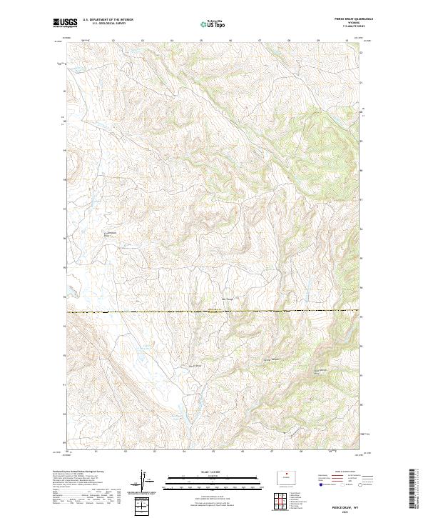
2021 Map of Pierce Draw
USGS Topo · Published 2021About this map
Pierce Draw and the surrounding high plains of north-central Wyoming are defined by a complex network of ephemeral drainages and essential water management features. The landscape is bisected by the Big Horn Co Washakie Co line, illustrating the administrative boundaries that cross this sparsely populated range. Water sources are the primary landmarks for navigation and land use here, with Deer Draw Reservoir in the northwest and Upper Reservoir centrally located to capture seasonal runoff.
Find a feature on this map
21 named features on this map. Tap any name to fly to it.
Don’t see what you’re looking for? This feature index may not catch every label — zoom into the map to look around manually.
Map Details
Editions of this 2021 Pierce Draw Map
This is the sole edition of this map. No revisions or reprints were ever made.
Other maps of this area

1899 · Cloud peak
USGS Topo · 1:125,000

1901 · Cloud Peak
USGS Topo · 1:125,000

1955 · Sheridan
USGS Topo · 1:250,000

1958 · Sheridan
USGS Topo · 1:250,000

1960 · Lake Solitude
USGS Topo · 1:24,000

1960 · Hyatt Ranch
USGS Topo · 1:24,000

1962 · Sheridan
USGS Topo · 1:250,000
1967 · Old Maid Gulch
USGS Topo · 1:24,000
1967 · Hyattville
USGS Topo · 1:24,000
1967 · Ten Sleep
USGS Topo · 1:24,000