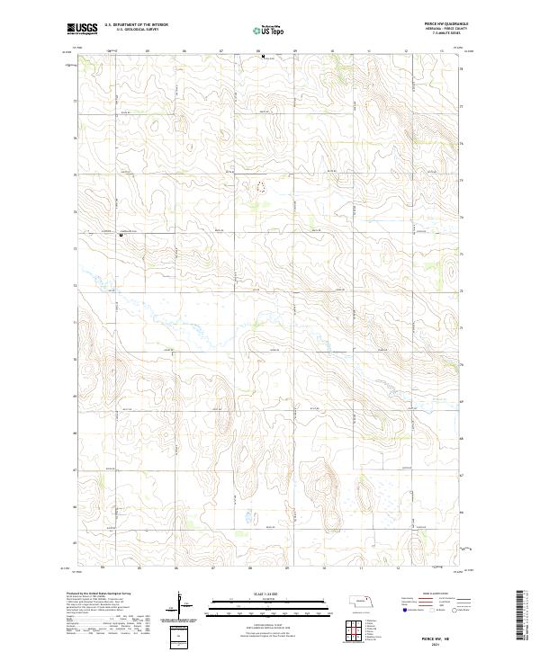
2021 Map of Pierce NW
USGS Topo · Published 2021About this map
Willow Creek meanders through this portion of rural Pierce County, carving a low valley across a landscape dominated by the Public Land Survey System’s geometric grid. The map document highlights the agrarian structure of the region, where section lines are traceably defined by a network of local roads including 854th Rd and 542nd Ave. For those researching family history in the area, the locations of Trinity Cem and Lambrecht Cem serve as important genealogical landmarks, anchoring the locations of early local communities. The terrain is characterized by the subtle drainage patterns of the northern Nebraska plains, with the waterway and its small tributaries providing the only significant break in the organized township divisions of t26n r4w and t26n r3w.
Find a feature on this map
21 named features on this map. Tap any name to fly to it.
Don’t see what you’re looking for? This feature index may not catch every label — zoom into the map to look around manually.
Map Details
Editions of this 2021 Pierce NW Map
This is the sole edition of this map. No revisions or reprints were ever made.
Other maps of this area

1955 · Sioux City
USGS Topo · 1:250,000

1958 · Sioux City
USGS Topo · 1:250,000

1959 · Sioux City
USGS Topo · 1:250,000

1963 · Pierce NW
USGS Topo · 1:24,000

1963 · Plainview
USGS Topo · 1:24,000

1963 · Pierce SE
USGS Topo · 1:24,000

1963 · Foster
USGS Topo · 1:24,000

1963 · Meadow Grove
USGS Topo · 1:24,000

1963 · Osmond
USGS Topo · 1:24,000
1963 · Tilden NE
USGS Topo · 1:24,000