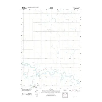
2011 Map of Pierce SE
USGS Topo · Published 2011About this map
Battle Creek sits at the southern edge of this Madison County landscape, where the namesake stream Battle Creek joins the larger Elkhorn River valley. The terrain is defined by the winding course of the river as it moves eastward, bordered by a rigid grid of rural roads like Benjamin Ave and Half Mile Rd. This layout reveals the late-twentieth-century transition of the Nebraska plains, where historical agricultural plots meet more modern infrastructure. Local genealogy is anchored by established sites such as Saint Patricks Cemetery near the town center and Best Cemetery further northeast. Small-scale aviation is represented by the B C Air Airport, while the Battle Creek Post Office serves as the community's central hub. To the north, the drainage of Hadar Creek cuts across the section lines, highlighting the subtle interplay between the natural waterways and the human-imposed survey system.
Find a feature on this map
30 named features on this map. Tap any name to fly to it.
Don’t see what you’re looking for? This feature index may not catch every label — zoom into the map to look around manually.
Map Details
Editions of this 2011 Pierce SE Map
This is the sole edition of this map. No revisions or reprints were ever made.
Other maps of this area

1955 · Sioux City
USGS Topo · 1:250,000

1955 · Fremont
USGS Topo · 1:250,000

1957 · Fremont
USGS Topo · 1:250,000

1958 · Sioux City
USGS Topo · 1:250,000

1958 · Fremont
USGS Topo · 1:250,000

1959 · Sioux City
USGS Topo · 1:250,000

1963 · Pierce NW
USGS Topo · 1:24,000

1963 · Battle Creek
USGS Topo · 1:24,000

1963 · Pierce SE
USGS Topo · 1:24,000

1963 · Emerick
USGS Topo · 1:24,000